Jean-Luc Demaret G
« A perfect family day on the Semois. The welcome at Kayak Belgique is warm, the equipment is spotless (the kayaks are modern and clean), and the free shuttle system is superbly organised. A must-visit in the Ardennes! »
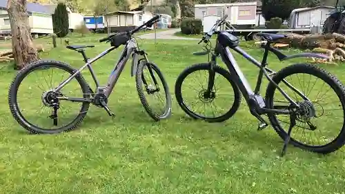
Centre Ardenne cycle route, mountain-bike loops, gravel tracks, node network and sweeping panoramas: an honest guide to riding in a magnificent valley… but a decidedly hilly one.
The Semois valley is a superb playground for cycling — provided you understand its terrain. A deeply incised river that winds for nearly 200 kilometres between Chiny and Bohan, the Semois has carved out a deep, sinuous, wooded valley. Here you ride mostly on the heights and from one slope to another, along quiet roads, gravel tracks and waymarked mountain-bike loops, rather than on a long flat ribbon by the water. It is demanding, often panoramic, and wildly refreshing. Even before choosing a route, keep this geographical reality in mind: it changes everything about how you prepare a ride.
This guide gives an honest overview of what is on offer: the Centre Ardenne cycle route, mountain biking around Vresse, gravel starting from Herbeumont, the real place of the RAVeL and the node network, the viewpoints reachable by bike, the value of the e-bike given the elevation gain, and the art of combining cycling and kayaking in a single trip. Without overselling: we tell you what really exists and what to expect.
Let us clear up a common misunderstanding first. Many people imagine the Semois like the Meuse or the Ourthe, with a flat RAVeL running alongside the river for dozens of kilometres. That is not the case. The Semois valley is too deeply incised and too winding to offer a long valley-floor route: there is no old railway line or continuous towpath that could be reused to follow the water from end to end. Cycling here is therefore done differently, and that is precisely what gives it its character.
In practical terms, riding here means climbing then descending. The villages, often nestled in a meander, are linked by roads that climb up to the plateau before plunging down to the next one. The cumulative elevation gain of a ride can be surprising. In return, every climb is rewarded with panoramas over the river's loops, forests as far as the eye can see and the peaceful atmosphere of the Ardennes plateaux. This is a region for those who love pedalling in the hills — or for those who equip themselves with an electric-assist bike.
No long flat cycle route by the Semois: here you ride on the heights, along quiet roads, gravel, mountain-bike trails and node routes — with elevation gain, real viewpoints, and an e-bike most welcome if you are not a seasoned cyclist.
This is the benchmark route for linking the region by bike. The Centre Ardenne cycle route connects, over about 97 kilometres, the Bastogne plateau to the Semois and Meuse valleys. It crosses a distillation of the Ardennes: hay meadows, great forests, plateau peat bogs and typical villages with their slate roofs. Conceived as a cycle-touring thread, it lets you discover the heart of the province over several days, linking major points of interest rather than following a single river.
On paper, 97 kilometres seem manageable; in Ardennes reality, expect a hilly profile and plan your effort accordingly. Many people ride it in two or three stages, stopping in a village in the evening to rest. It is a fine gateway to the Semois: heading south, you gradually shift from the plateaux towards the wooded meanders of the valley, as far as the outskirts of Bouillon and its fortress. An excellent way to understand the geography of the region before, or after, a kayak descent.
To sample mountain biking in the valley without mounting an expedition, the loop of about 20 kilometres starting from the Pont Saint-Lambert, at Vresse-sur-Semois, is a safe bet. Followed thanks to yellow waymarking, it climbs the slopes, crosses the woods and offers fine glimpses of the river and its loops. The format is ideal for a half-day: long enough to feel deep in nature, short enough to stay within reach of a reasonably fit intermediate mountain biker.
As always here, the elevation gain makes the difficulty as much as the distance. The 20 kilometres are earned: a few climbs on track may require you to get off and push, depending on your form on the day and the state of the ground after rain. Nothing extreme, but a mountain bike in good condition, reliable brakes and a little off-tarmac habit are recommended. Vresse is also an excellent base camp: the village, renowned for its hiking trails around Vresse, lets you alternate pedalling and walking according to your mood and the weather.
Gravel — those robust road bikes built for tracks — is arguably the most modern and most freeing way to explore the region, because it effortlessly links quiet roads and forest tracks. The route "The Semois Valley between Ardenne and Gaume" starts from Herbeumont, at the hinge between the forested Ardenne and the gentler Gaume. It bridges two landscape moods, which makes it a particularly varied route.
Let us be clear about the level: this route is presented as accessible, but already demanding for a touring cyclist. In other words, it does not call for the technical handling of a mountain biker, but it demands a good level of fitness and the habit of riding on mixed surfaces (minor roads, tracks, stony paths). The charm of gravel lies precisely in this versatility: you string together surfaces without changing bikes, keeping a good rhythm where a mountain bike would be too slow and a road bike too limited. Herbeumont, tucked into a meander at the foot of its castle ruins, is an inspiring starting point.
Two systems complete the offer at the scale of Wallonia, without running alongside the Semois continuously. You need to understand their respective roles so as not to set off with the wrong expectations.
The RAVeL (Réseau Autonome des Voies Lentes, the autonomous network of slow ways) is the Walloon network of routes reserved for non-motorised users, laid out on old railway lines and towpaths. Its sections are flat and safe, perfect for families. But, to repeat, it does not follow the Semois along the valley floor: it should be seen as a regional complement that lets you link neighbouring valleys and reach the region gently, rather than as a waterside path. Combining a few kilometres of RAVeL with plateau roads remains a good strategy for limiting traffic.
The node network (cycle nodes) is arguably the most practical tool for putting together your rides in the region. The principle is simple: numbered junctions are distributed across the territory, and you plot your route by adding up the numbers to follow. You can thus build your loop à la carte, lengthen or shorten it according to your form, and find your way without GPS thanks to the signposts. It is ideal for exploring the plateaux and villages around the valley at your own pace, keeping control of the distance and the elevation gain.
The terrain has a happy flip side: every climb leads to a panorama. Two emblematic belvederes of the valley are reachable by bike for those willing to climb — or to call on electric assistance.
These belvederes lie on the heights: reaching them by bike means a real climb from the valley floor, but the visual reward matches the effort. For other panoramas and access advice, browse our page dedicated to the viewpoints and belvederes of the Semois: it lists the valley's major sites, on foot as much as by bike.
This is the most important point to take on board before booking a cycling trip in the region. The terrain is the real challenge, far more than the technique. An occasional cyclist expecting flat outings risks being caught out by the hills. Two options are open to you.
If you are well trained, the elevation gain becomes an asset: firm climbs, long descents, guaranteed thrills on a classic, gravel or mountain bike. If you ride more occasionally, or as a family, the electric-assist bike (e-bike) is strongly recommended: it turns the hills into a pleasure, brings the finest viewpoints within everyone's reach and lets you enjoy the scenery without ending up exhausted. In a valley this hilly, the e-bike is not a luxury but a true equaliser of experience.
As for the season, the best window runs from April to October. Spring offers forests in tender leaf and drained tracks; summer, busier, invites early starts; autumn sets the slopes ablaze in copper and gold, with calmer plateaux. Outside this window, short days, waterlogged tracks and frost make outings more technical.
| Format | For whom / what to expect |
|---|---|
| MTB loop ~20 km (Vresse) | Fit intermediate mountain biker; half a day; real elevation gain, possible muddy sections after rain. |
| Herbeumont gravel | Touring cyclist with good fitness; mixed surfaces; accessible but demanding. |
| Centre Ardenne cycle route (~97 km) | Cycle touring over 2–3 days; hilly profile; stopover villages. |
| Node network / RAVeL | À la carte, families included; choose short, gentle sections, or switch to an e-bike. |
The Semois valley lends itself magnificently to a "two elements" weekend: water and land. The simplest approach is to alternate days. One day, you descend the river with the current; the next, you climb the plateaux by bike to discover the valley from above. The two activities answer each other: the kayak reveals the Semois at water level, between meanders and riverbank woodland, while cycling unveils the panoramas from the ridges. You go home with a complete picture of the valley, from the water's floor up to the belvederes.
For the logistics, choose a central base camp — Bouillon, Vresse or Herbeumont — from which you radiate out to the launch points and the starts of the loops. Book the descent of the Semois by kayak for the day when the weather and water level are most favourable, and keep the cycling ride as a complementary plan, more flexible in the face of the weather's whims. In between, a natural swim in the Semois makes a perfect break on hot days.
On the hire side, several firms and seasonal points offer mountain bikes and e-bikes in the main tourist villages — notably around Bouillon, Vresse-sur-Semois and Herbeumont — as well as through certain accommodation providers and tourist offices. The offer changes from year to year and season to season; the most reliable option is to contact in advance the local tourist office or your host, who will point you to an open hire firm and advise you on the bike suited to the terrain. Do not count on finding a bike to hire at the last minute in high season without having booked.
On the accommodation side, the valley abounds in options for parking your bikes in the evening, from the gîte to the campsite by way of more original formulas. For an out-of-the-ordinary night between two rides, see our ideas for unusual accommodation on the Semois, and for lovers of raw nature, our page on bivouac in the Ardennes along the Semois. A good roof, central and bike-friendly, does much for the success of an active trip.
Cycling in the Semois valley is not a flat stroll along the water, and so much the better: it is an adventure of plateaux, forests and viewpoints, for those who accept a little climbing — or who switch on some assistance. Between the Centre Ardenne cycle route, the Vresse mountain-bike loop, the Herbeumont gravel, the regional RAVeL and the node routes, everyone builds the ride that suits them. And to grasp the full soul of the region, nothing beats marrying land and water. Discover the valley from below by booking your descent of the Semois by kayak, then take to the heights by bike — you will keep the memory of a complete trip. To plan your whole getaway, our page on tourism in the Semois valley gathers all the activities and good addresses of the region.
Sources: National Park of the Semois Valley (heritage and routes of the valley); Wallonia Tourism / VisitWallonia (Centre Ardenne cycle route, regional cycle network); SPW – RAVeL Wallonia (network of slow ways); tourist office and municipalities of the valley, including Vresse-sur-Semois (Pont Saint-Lambert MTB loop) and Herbeumont (gravel route "The Semois Valley between Ardenne and Gaume"); cycle node network of the province of Luxembourg. Hire providers and waymarking change from one season to the next: check practical information with the local tourist offices before setting off.
Noté 4.6/5 sur 1282 avis
« A perfect family day on the Semois. The welcome at Kayak Belgique is warm, the equipment is spotless (the kayaks are modern and clean), and the free shuttle system is superbly organised. A must-visit in the Ardennes! »
« Beautiful kayak trip on the Semois starting from Vresse! Very friendly staff and excellent shuttle service. The riverside campsites along the Semois are also a must for nature lovers. »
« Superb 11 km kayak descent starting from Alle-sur-Semois. The wild nature of the Ardennes is magnificent in the spring sunshine. Very competitive prices compared to the competition. We'll be back! »
« Wonderful experience! The kayak tour on the Semois was perfectly organised. The team is very helpful and speaks good German. The scenery of the Belgian Ardennes is simply breathtaking. »
« Excellent kayak rental service and great campsite on the banks of the Semois. The prices are very fair and the atmosphere is friendly and family-oriented. The little terrace bar is perfect for a refreshing drink after the effort. »
« A fantastic last-minute welcome even though we hadn't booked in the middle of August. Life jackets and waterproof barrels are provided free of charge. Very safe descents, ideal with children! »
« Top-tier kayak rental on the Semois river. Extremely friendly staff, well-maintained kayaks, and a reliable shuttle. The viewpoints along the river are absolutely stunning. Highly recommend this local business! »