Jean-Luc Demaret G
« A perfect family day on the Semois. The welcome at Kayak Belgique is warm, the equipment is spotless (the kayaks are modern and clean), and the free shuttle system is superbly organised. A must-visit in the Ardennes! »
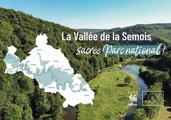
From the long thread of the GR16 to the panoramic loops of the Giant's Tomb and Rochehaut: where to walk in the Semois valley, from family strolls to sporty routes, without overselling the trails.
The Semois valley is one of the finest hiking grounds in the Ardennes. The river has carved deep meanders here between wooded, steep slopes, and it is precisely this tortured topography that makes walking so rich in these parts: you climb onto a plateau, look down over a meander, drop back towards a village nestled at the water's edge, then climb again to tackle the next slope. This relief is hiked along a guiding thread, the GR16 "Semois Trail", complemented by a constellation of waymarked loops starting from the villages. This page takes an honest look at hiking in the valley: the route of the GR, the most striking loops, the real levels, the equipment, the safety, and how to combine walking, kayaking and wild camping.
Let us be clear from the outset, as always here: the Semois is not high mountain country, but its trails are no walk in the park either. The gradient has to be paid for, the paths are often rocky, root-strewn and slippery in wet weather, and local waymarking varies from one village to the next. A good pair of shoes, a map or a topo-guide, and a minimum of preparation turn a fine idea into a fine day out.
The GR16 follows the Semois for about 200 km, from Arlon to Monthermé, waymarked in white and red. Around it, half-day to full-day loops serve the flagship sites. Bring walking shoes, water, a snack and an IGN map or GR topo-guide; adapt the route to the group's level; respect the wildlife, private property and the protected zones. The slopes get slippery after rain: take care on the descents.
The GR16, nicknamed the "Semois Trail", is a long-distance footpath that accompanies the river along its entire course, some 200 kilometres. It sets off near Arlon, not far from the source of the Semois in Belgian Lorraine, and runs down to Monthermé, in France, where the Semois flows into the Meuse. Between the two, it unspools the whole Ardennes valley: the agricultural plateaus of the upper Semois, the wooded gorges of the central part, the spectacular meanders of the lower valley around Bouillon, Rochehaut and Vresse.
Like all the long-distance footpaths in the network, the GR16 is identified by its white-and-red marks painted on trees, rocks and street furniture. Two stacked stripes indicate the path, an angle signals a change of direction, and a white-and-red cross warns of a wrong direction. This waymarking is maintained by the volunteer trail markers of the Sentiers de Grande Randonnée. It nevertheless remains wise to back up this signage with a topographic map or the official topo-guide of the GR16, as some junctions with local paths can cause confusion.
Few walkers swallow the 200 km in one go. Most proceed in stages, linking two villages with accommodation each day, or in day sections grafted onto a local loop to return to their starting point. The most popular sections are those of the lower Semois, notably Bouillon–Rochehaut, where the trail strings together viewpoints. To plan a walking trip, it helps to list first the viewpoints of the valley you absolutely want to see, then build the route around them.
The GR is the thread, but it is often the local loops that deliver the strongest emotions, because they deliberately climb up to seek out the belvederes. Here are the must-dos, presented honestly, with their character and their demands.
This is probably the most emblematic hike in the whole valley. Starting from the hamlet of Botassart, the loop leads to the belvedere overlooking the Giant's Tomb, that wooded, tumulus-shaped hill enclosed in a perfect meander of the Semois — one of the most photographed landscapes in Belgium. The view is striking, particularly at daybreak when the mists of the Semois cling to the valley floor. The route stays accessible to an average walker, but the viewpoint itself has to be earned with a few climbs.
At the opposite end of the spectrum, the Rochehaut ladders make up the most sporty route in the area. From the village of Rochehaut, perched on its promontory, the path plunges towards the river then climbs back up a very steep slope, equipped in places to aid progress. The gradient is significant and the terrain demanding: this is not a loop for young children, nor to be attempted on soggy ground. The reward, on the other hand, matches the effort, with plunging panoramas over the Frahan meander.
Linking the hamlet of Frahan, nestled right at the water's edge in its meander, to the Rochehaut belvedere on the heights, this loop is one of the great classics of the lower Semois. It combines the crossing of the meander, the passage over the footbridge across the river and the climb back up to the famous Rochehaut viewpoint, considered one of the finest in the valley. The Frahan and Bouillon area alone holds enough to fill several days of walking.
Gentler and more family-friendly, the Legends Walk starting from Laforêt, within the municipality of Vresse-sur-Semois, offers a themed discovery of the lower valley, dotted with evocations of local folklore. It suits an outing with children well, or a day when you want to walk without tackling big gradients. Laforêt is, moreover, recognised among the most beautiful villages of Wallonia, which adds to the charm of the route.
The valley does not stop at the stars. The country of Vresse-sur-Semois unfolds a whole network of waymarked walks between river, meadows and woods — to be found in our dedicated guide to the hikes of Vresse-sur-Semois. Around Herbeumont, the paths climb towards the castle ruins and offer broad views over the upper valley. Further upstream, the Chassepierre loop winds around a charming artists' village, in a peaceful, bucolic meander.
The Semois valley has the advantage of offering all levels, provided you choose your route knowingly. The relief changes everything: the same distance on the flat has nothing to do with the same distance on a slope. Here is how to find your way.
| Profile | What suits |
|---|---|
| Families & children | Valley-floor walks and themed loops such as the Legends Walk at Laforêt; flat sections of the GR along the river. Avoid the steep climbs and the equipped passages. |
| Regular walkers | Most of the panoramic loops: the Giant's Tomb at Botassart, Frahan–Rochehaut, the paths of Herbeumont and Vresse. Good gradient but without any major technical difficulty. |
| Sporty hikers | The Rochehaut ladders and the linked slopes; the multi-day trekking of the GR16 with a pack. Steep terrain, long climbs, vigilance on the descents. |
One cross-cutting piece of advice: never judge a loop by its distance alone. On the slopes of the Semois, eight kilometres can be more tiring than fifteen on the flat. Always look at the cumulative gradient and the nature of the terrain before setting off, especially in a mixed group.
Nothing alarming, but the Semois valley calls for the minimum seriousness that applies to any hike in wooded mid-mountain country. The forest is beautiful but can disorient, the Ardennes weather changes fast, and the hillside trails do not forgive unsuitable shoes.
The great luxury of the Semois valley is being able to string together ways of exploring it. The river and its trails answer one another: what you look down on from a belvedere in the morning, you can cross by paddle in the afternoon. Many visitors thus put together trips mixing walking, whitewater and nights out in the wild.
Nothing stops you devoting one day to the descent of the Semois by kayak and the next to a hiking loop on the heights. The contrast is striking: the river offers the view from the valley floor, the path the view from the ridges. The villages that serve as launch points — Bouillon, Vresse, Alle, Herbeumont — are also excellent starting points for walks, which simplifies the logistics.
Fans of two wheels will find their happiness on the RAVeL and mountain-biking routes of the Semois, which ideally complement the walking paths. To extend the adventure over several days, the region lends itself to wild camping in the wild — but within a regulated framework: in Wallonia, wild camping is only allowed on the official areas of the regional network, for one night, and forbidden elsewhere, in particular in nature reserves and Natura 2000 zones. So you cannot pitch your tent at the water's edge on a whim.
Enough to sample every face of the Semois in a single weekend, without ever forcing the pace.
To walk in the Semois valley is to step right into the wild Ardennes: its forests, its ridges and its preserved rivers. The valley is largely covered by the National Park of the Semois Valley, a guarantee of a protected landscape where nature keeps its rights. The hiker has a simple but essential role here: to pass through without leaving a trace, as a discreet observer rather than a conqueror.
This means staying on the waymarked paths, picking and disturbing nothing, keeping dogs on a lead near wildlife and livestock, and savouring the silence rather than breaking it. It is at this price that the most beautiful viewpoints of the valley will remain just as intact for those who come after us. Hiking is not only a performance: it is a way of looking.
From the long backbone of the GR16 Semois Trail to the finely cut loops of the Giant's Tomb, the Rochehaut ladders or Frahan, the valley offers a range of hikes that runs from the family stroll to the sporty effort. All you have to do is choose the route to match your ability, equip yourself properly, respect nature and private property, and keep in mind that the relief always has to be paid for. Approached this way, walking in the Semois valley ranks among the finest in the Ardennes — and pairs ideally with a descent of the river by kayak to discover the two faces of the valley, that of the ridges and that of the water.
Sources: National Park of the Semois Valley (heritage and trails of the valley); Les Sentiers de Grande Randonnée / SGR asbl (route and waymarking of the GR16 "Semois Trail"); VisitWallonia and the local tourist offices of Bouillon, Vresse-sur-Semois and Bertrix-Herbeumont (waymarked loops, viewpoints); Ardenne & Gaume (Bohan-Membre nature reserve); Walloon regulations on wild camping in forests (network of bivouac areas). Levels and distances vary according to the variants taken: always refer to an up-to-date topo-guide or IGN map, and check local conditions before setting off.
Noté 4.6/5 sur 1282 avis
« A perfect family day on the Semois. The welcome at Kayak Belgique is warm, the equipment is spotless (the kayaks are modern and clean), and the free shuttle system is superbly organised. A must-visit in the Ardennes! »
« Beautiful kayak trip on the Semois starting from Vresse! Very friendly staff and excellent shuttle service. The riverside campsites along the Semois are also a must for nature lovers. »
« Superb 11 km kayak descent starting from Alle-sur-Semois. The wild nature of the Ardennes is magnificent in the spring sunshine. Very competitive prices compared to the competition. We'll be back! »
« Wonderful experience! The kayak tour on the Semois was perfectly organised. The team is very helpful and speaks good German. The scenery of the Belgian Ardennes is simply breathtaking. »
« Excellent kayak rental service and great campsite on the banks of the Semois. The prices are very fair and the atmosphere is friendly and family-oriented. The little terrace bar is perfect for a refreshing drink after the effort. »
« A fantastic last-minute welcome even though we hadn't booked in the middle of August. Life jackets and waterproof barrels are provided free of charge. Very safe descents, ideal with children! »
« Top-tier kayak rental on the Semois river. Extremely friendly staff, well-maintained kayaks, and a reliable shuttle. The viewpoints along the river are absolutely stunning. Highly recommend this local business! »