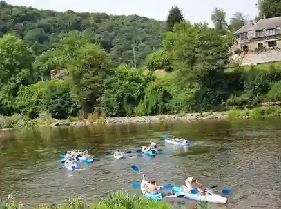
The Semois, the Lesse, and the Amblève account for most kayaking trips in the Belgian Ardennes. However, two quieter rivers are well worth the detour for paddlers seeking peace and unspoiled nature: the Salm, a spirited tributary of the Amblève at Trois-Ponts, and the Viroin, a peaceful river in the Calestienne region. Here is everything you need to prepare for these routes — itineraries, season, and regulations. To compare them with the main rivers, see which river to choose.
The Salm
Trois-Ponts · Vielsalm · Liège Ardennes
A wild tributary of the Amblève, the Salm rushes through the forests of the Ardennes from Vielsalm to Trois-Ponts, where it meets the Amblève just steps away from the Coo waterfalls. More spirited than the Semois and more secluded than the Lesse, it rewards experienced paddlers: current, technical handling (class II to III depending on water levels), and total immersion in nature.
Routes
- 5 km · Discovery
Trois-Ponts — Discovery — First encounter with the Salm on its downstream section down to its confluence with the Amblève. Brisk yet manageable current, wooded slopes of spruce and beech. The perfect initiation to sample the river's energetic character.
- 8 km · Sporty
Grand-Halleux → Trois-Ponts — The flagship route for whitewater enthusiasts: ledges, small class II-III rapids, and sharp turns under the canopy. Reserved for paddlers who already master edging and steering.
- 14 km · Adventure
Vielsalm → Trois-Ponts — For experienced kayakers: fourteen kilometers of raw Ardennes through the former Principality of Salm, combining technical passages and rocky chicanes in a virtually deserted valley.
Geography
From its sources in the High Fens of the East Cantons to its confluence with the Amblève in Trois-Ponts, the Salm winds for nearly 28 km through one of the most heavily forested valleys in the Ardennes. The river gave its name to Vielsalm and the former Principality of Salm, a small sovereign state of the Holy Roman Empire. Narrower and steeper than the major tourist routes, the Salm offers a rocky riverbed, rapids, and tight bends — a technical and lively river, the exact opposite of a gentle cruise.
Flow rate and water level
As a headwater river, the Salm reacts quickly to rainfall on the Ardennes plateau: its level can rise — or drop — in just a few hours. Water levels are tracked on the Amblève water level page. Amblève water level (Salm basin).
When to go?
Spring (Apr–May)
The prime period: strong flow, well-fed rapids, vibrant vegetation.
Summer (Jun–Aug)
Lower levels on the upper sections; downstream routes remain navigable. Low crowds. Weekend reservations recommended.
Autumn (Sep–Oct)
Flow rises again, the forest turns ablaze with color. Wild atmosphere in a nearly empty valley.
Winter (Nov–Mar)
Activity suspended during floods or freezing conditions. Partner rental centers closed off-season.
Booking & Preparation
The Salm joins the Amblève at Trois-Ponts, just upstream from the Coo waterfalls: many paddlers combine a Salm run and an Amblève run on the same weekend, managed by the same partner rental provider. Advance booking is recommended, at least 48 hours ahead, especially on weekends and during peak season. All nautical equipment (kayak, life jacket, paddle, helmet depending on the route) is provided.
Prepare your trip
The Viroin
Olloy · Vierves · Treignes · Viroin-Hermeton Nature Park
Born in Nismes at the meeting of the Eau Noire and Eau Blanche, the Viroin crosses one of Wallonia's most preserved valleys from east to west before joining the Meuse in France. A river of the Calestienne region, it offers a steady and accessible current (class I to II): a peaceful trip where you paddle to the rhythm of nature rather than rapids.
Routes
- 6 km · Discovery
Vierves → Treignes — The most accessible section of the Viroin, running between the charming villages of Vierves-sur-Viroin and Treignes. Six kilometers of clear, lively water beneath the limestone lawns of the Calestienne — ideal for a first family trip when water levels allow.
- 6 km · Nature
Olloy-sur-Viroin → Vierves — Starting from Olloy, this route crosses the wild heart of the Viroin-Hermeton Nature Park: the river winds between limestone hills, alder forests, and nature reserves — a biodiversity corridor where kingfishers and dippers thrive.
Geography
From its origin in Nismes to its entry into France at Vireux, the Viroin flows for about twenty kilometers through the Calestienne, one of Wallonia's richest limestone belts for biodiversity. It runs along the foot of 'tiennes', limestone hills topped with dry grasslands; in Nismes, the Fondry des Chiens bears witness to karst erosion. The entire valley is protected within the Viroin-Hermeton Nature Park. The villages of Vierves-sur-Viroin and Olloy, among the prettiest in Wallonia, dot the route.
⚖️ Regulated navigation: on the Viroin, kayaking is permitted from the confluence (Nismes) to the Treignes bridge, with mandatory embarkation and disembarkation points to protect the banks and wildlife of the Nature Park. Embarkation at Vierves is located upstream of the bridge (right bank), and disembarkation at Treignes is upstream of the Rue Basse aux Raines bridge (right bank). Navigation is suspended during severe low water or high water conditions.
Flow rate and water level
Water levels depend on rainfall across the Couvin and Chimay basins. In summer, the level is often too low and kayaking may be limited or suspended: always check before heading out. Navigable flow rates in Wallonia (SPW thresholds).
When to go?
Spring (Apr–Jun)
The best period: generally reliable flow, vibrant valley, orchids blooming on the limestone slopes.
Summer (Jul–Aug)
Often low water levels: navigation sometimes restricted or suspended on certain sections. Low crowds. Check water levels before booking.
Autumn (Sep–Oct)
Flow increases with rain, autumn colors light up the wooded slopes. Peaceful and wild ambiance.
Winter (Nov–Mar)
Kayaking is generally suspended (floods, cold, wildlife protection). Season for exploring the museums of Treignes.
Booking & Preparation
Kayaks are rented through local operators (L'Étape de Viroinval in Treignes); availability is limited, so book in advance and confirm the navigation calendar with the Viroinval Tourist Office. Surrounding highlights: Fondry des Chiens and the Nismes grasslands, the Viroin Ecomuseum and Espace Arthur Masson in Treignes, the Three Valleys Steam Railway, and the heritage villages of Vierves and Olloy. Ideal for a nature and culture weekend.
Prepare your trip
Frequently Asked Questions
Is the Salm suitable for beginners?
The 5 km discovery route in Trois-Ponts is accessible to beginners accompanied by guides after a safety briefing. The routes starting from Grand-Halleux and Vielsalm feature class II-III whitewater and require solid kayaking skills.
Does the Salm join the Amblève?
Yes, the Salm meets the Amblève at Trois-Ponts, just upstream from the Coo waterfalls. Many paddlers combine a Salm trip with an
Amblève kayaking trip on the same weekend.
Is the Viroin suitable for families?
Yes, when water levels are sufficient. The Vierves–Treignes and Olloy–Vierves sections are class I-II, making them accessible for families and accompanied beginners.
Where do you put in and take out on the Viroin?
Embarkation at Vierves takes place upstream of the Viroin bridge (right bank) and disembarkation at Treignes is upstream of the Rue Basse aux Raines bridge (right bank). These designated points protect the riverbanks and wildlife of the Viroin-Hermeton Nature Park.
Can kayaking on the Viroin be prohibited?
Yes. Navigation is suspended during severe low water (levels too low) as well as high water (dangerous flow), and is subject to Nature Park regulations. Always check the calendar with the Viroinval Tourist Office before booking.